


Mapping the Jurassic Coast
Mapping the offshore extension of the Jurassic Coast World Heritage Site
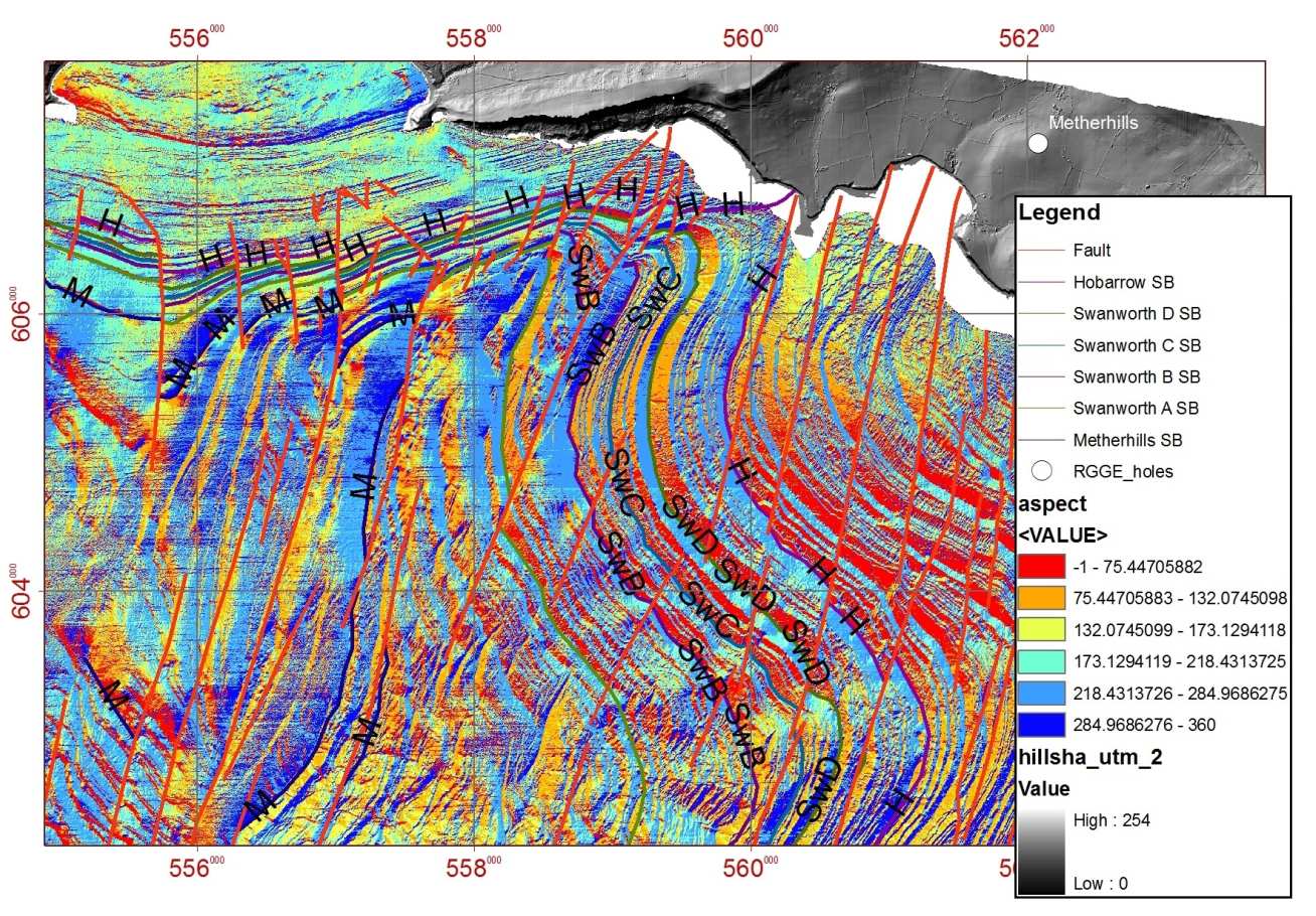
These geological maps were produced as part of a joint MAREMAP project involving the BGS and David Sanderson of the University of Southampton. It used offshore sea bed multibeam data collected as part of the DORIS project, and onshore aerial Lidar data collected as part of the National Network of Regional Coastal Monitoring Programmes, coordinated by the Channel Coastal Observatory (CCO). These were stitched together to form a seamless elevation surface across the coastal zone, fully revealing its geomorphological and geological detail. The offshore mapping is accurate to the same 1:10 000 scale as the onshore mapping, and provides unprecedented detail on the geological structures extending across Weymouth Bay, and around the Isle of Portland to the west and the eastern end of the Isle of Purbeck.
Publications
Westhead, R. K., D. J. McCarthy, J. S. Collier and D. J. Sanderson (2017). "Spatial variability of the Purbeck–Wight Fault Zone—a long-lived tectonic element in the southern UK." Proceedings of the Geologists' Association. 10.1016/j.pgeola.2017.08.005 PDF
Sanderson, D. J., J. K. Dix, K. R. Westhead and J. S. Collier (2017). "Bathymetric mapping of the coastal and offshore geology and structure of the Jurassic Coast, Weymouth Bay, UK." Journal of the Geological Society 174: 498-508. 10.1144/jgs2016-070 PDF