Planet Earth is alive: using mathematics to understand and protect our world
Current students from the MPE CDT welcome visitors to the exhibition. Image credit: James Mason Photography
The interactive Mathematics of Planet Earth exhibition explored how maths underpins multidisciplinary approaches to complex questions about our world.
The EPSRC Mathematics of Planet Earth Centre for Doctoral Training (MPE CDT), run jointly between Imperial College London and the University of Reading, trains students in mathematical and computational techniques required to predict and quantify uncertainty and risk for extreme weather and climate change.
Felicity Buchan MP officially opened the MPE CDT's annual exhibition on the 15 February, along with Professor Jennifer Scott (Director of Reading MPE CDT) and Professor Richard Craster (Dean of the Faculty of Natural Sciences, Imperial). The exhibition gives visitors of all ages the chance to interact with models, videos and computer programmes demonstrating the vital role mathematics plays in understanding Earth’s complex systems, including in the fields of astronomy, fluid dynamics, seismology, glaciology and cartography.

The official opening! L-R Professor Dan Crisan (Director MPECDT), Felicity Buchan MP, Professor Richard Craster (Dean of the Faculty of Natural Sciences, Imperial) and Professor Jennifer Scott (Director of Reading MPE CDT)

Staff and students from the MPE CDT welcome visitors to the exhibition

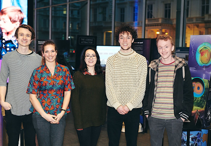
Staff from the MPE CDT at the opening of the exhibition
A day in the world of Wetropolis
One of the most popular exhibits, the model city of Wetropolis, is populated with Smurf and Lego figurines, and aims to demonstrate how various rainfall scenarios affect river-flood events. A Wetropolis day is set to last ten seconds via a mechanical generator, which randomly selects how long rainfall lasts – somewhere between one and nine seconds – and whereabouts in Wetropolis it will fall. One option is over the model city's sea, which includes a device that operates like the Thames Barrier, giving visitors some control over the influx of water travelling into the Wetropolis river. Another option is over the moor, where the terrain stores water naturally – the water flows through this area at a gradual rate and is out of the city's control. The reservoir area nearby has a fixed limit; Wetropolis can prevent flooding from its reservoir by releasing water during periods of dry weather. The worst-case scenario – nine-second rainfall over both the sea and the reservoir – occurs around every six minutes, and if anticipated in time the city can mitigate flooding by pulling their sea barrier device up, restricting water flow from sea to river.

The city of Wetropolis

Professor Onno Bokhove (School of Mathematics, University of Leeds) devised Wetropolis - here he demonstrates how the random weather generator works

MPE PhD student Mariana Clare explains to visitors how Wetropolis works

Visitors play with Wetropolis as it rains on the moor land and reservoir

Ducks on the Wetropolis moorland

Visitors play with Wetropolis

Professor Onno Bokhove (School of Mathematics, University of Leeds) who devised Wetropolis, stands next to the random weather generator
The goal of this model is to better understand the random nature of weather, and its impact on disaster events. Tom Gregory, a first year MPE PhD student, highlights a range of questions it aims to interrogate: ‘How do you plan for events and work out how often severe weather will occur? How do our controls influence the situation? Is our moor actually doing anything to help prevent floods, or is it hindering our attempts? Can we control this in any way?’
Models – both physical, like Wetropolis, and mathematical – help researchers and policy-makers to make decisions about how to engineer and monitor solutions. ‘As academics we’re interested in trying to minimise the risk,’ says Tom. Some of the younger visitors to the exhibition had a different approach, however, devising ways to induce the flooding of Smurf city: ‘for some of our visitors maximising the flood risk in Wetropolis provides more entertainment!’
Uncertainty in forecasting
 Another model in the exhibition illustrates how the patterns made by magnets can help mathematicians deal with uncertainty in weather prediction. A metal pendulum hovers over three equally spaced magnets of equal strength. ‘We can predict the path of the pendulum quite accurately, as long as we know where we started,’ explains Tom, ‘and that’s the hard bit, knowing exactly where you started’. In theory, if you let the pendulum go directly above a red region, and attempt not to exert any extra force on it, it should end up on the red magnet. However, a small variation, such as a wavering hand or a small unintentional force, can significantly alter the outcome.
‘That’s an issue in our weather and ocean forecasting – you can’t ever be one hundred percent accurate with where you start, and if you have some intrinsic chaos in your system, things will diverge over time. We mostly understand the physics of the problem, but trying to understand how where we start impacts where we finish is a major issue in trying to understand predictability and uncertainty in systems, and how they change over time.’

The UK has two major weather centres that produce independent forecasts – ‘in fact, just a few days ago the government announced a major £1.2 billion investment for a new supercomputer at the MET Office’, says Tom. ‘They’ve worked out that every pound spent in weather forecasting gives about nineteen pounds back to the economy, because you’re predicting these disasters better, so you know where to put your resources’. He emphasises that ‘we can predict with some accuracy maybe five to seven days in advance’. In the case of Storm Dennis, for example, experts had just six days advance notice. ‘The general rate of improvement for forecasts is a day’s accuracy per decade, so … in about ten years we expect to be able to predict seven days in advance as accurately.’
All maps are wrong
Joe Wallwork, a final year MPE PhD student, highlights one of his favourite items in the exhibition, All maps are wrong, which illustrates how easy it is ‘to forget that a map represents a three-dimensional object’. Maps that we see and use every day are constructed in different ways and employed for varied purposes. The interactive exhibit allows visitors to visualise distortions that arise on different types of map and to consider the principles that underpin applications like Google Earth.
‘On the standard map – the one you’ll see most often – the globe is very well represented near the equator, but as you go further north and south areas become distorted – for example Greenland is massively distorted in the north, south, east and west.’

Screen showing a Plate Carrée projection map

Screen showing the Azimuthal equidistant projection

Screen showing the Gnomonic projection

Screen showing the Stereographic projection

Screen showing the Mollweide projection

Screen showing the Mercator projection

Screen showing the Gall-Peters projection
Joe emphasies the importance of appreciating that, however we represent something, there will always be some element of distortion: ‘so it’s either shape, area, or straight lines, and you can never accurately fulfill more than one of those elements in a single map. It’s mainly about being aware that maps can give inaccurate impressions and to try and figure out which map is useful in different scenarios.’
Shifting sediments and the string house
Predicting and modelling high-risk, low-frequency events like earthquakes is a central focus for a number of researchers at MPE. Their string house exhibit sits on a board that can be wobbled in myriad ways. ‘Here we’re modelling earthquakes’, says Tom, ‘experimenting with the different kinds of vibrations and waves that occur during these events to see what effect they have on the house. Can we make the house roll with the oscillation rather than hold all the energy in a vibrating structure?’

MPE PhD student Tom Gregory talks with visitors about the string house and the rotating sediment models

A visitor re-stacks the fallen string house

MPE PhD student Joe Wallwork talks with a visitor about the string house

Visitors interact with the rotating sediment model

MPE PhD student Mariana Clare talks with visitors about the rotating sediment model
The MPE exhibition also includes a sediment model made up of two substances – cous cous and glass beads – both of which have different coarseness. Patterns emerge as the model is rotated, and if this is done gradually a small bulge begins to form, which eventually becomes a tipping point when the matter all falls at once. ‘The coarser grains flow on the bottom', explains Tom. 'They fall first, which leads to a kind of spiked pattern – the less coarse material flows over the top.' Analysing sediment flow helps to illustrate the dynamics of, and risks posed by, avalanches, from their triggering to their impact on other objects.
Find out more
Learn more about the mathematics behind everything from glaciers, tsunamis, avalanches and oceanography, to satellites, gravity, fractals and earthquakes: view the free exhibition booklet to access summaries and images of all the exhibits.
Stay up to date with MPE CDT news, events and opportunities:
Many thanks to the organisers
The Exhibition is organised in collaboration with partners from Centre•Sciences (CCSTi Region Centre - Val de Loire), the Imaginary Network and the University of Leeds. The local organisers are Barsha Shrestha (Manager MPECDT) and Professor Dan Crisan (Director MPECDT).
Professor Onno Bokhove, from the School of Mathematics, University of Leeds, devised Wetropolis, in collaboration and with insights from the MPE CDT. The first mathematical design of Wetropolis was presented at the MPE CDT on 1 June 2016. Wetropolis was funded by the EPSRC (Maths Foresees Network), Schools of Mathematics and Civil Engineering (University of Leeds), Fluid Dynamics' CDT Leeds, and also the JBA Trust.
The MPE exhibition partners reception on 18 February 2020 was partially funded by the Quantitative Sciences Research Institute (QSRI).
Photo credits
- James Mason Photography
- Images of the All maps are wrong exhibit, author's own
Article text (excluding photos or graphics) © Imperial College London.
Photos and graphics subject to third party copyright used with permission or © Imperial College London.
Reporter
Claudia Cannon
The Grantham Institute for Climate Change