Reconstructing Prehistoric landscapes using seabed imagery
A project conducted under the Marine Aggregates Levy Sustainability Fund Phase I (administered by English Heritage).
The project report can be downloaded here
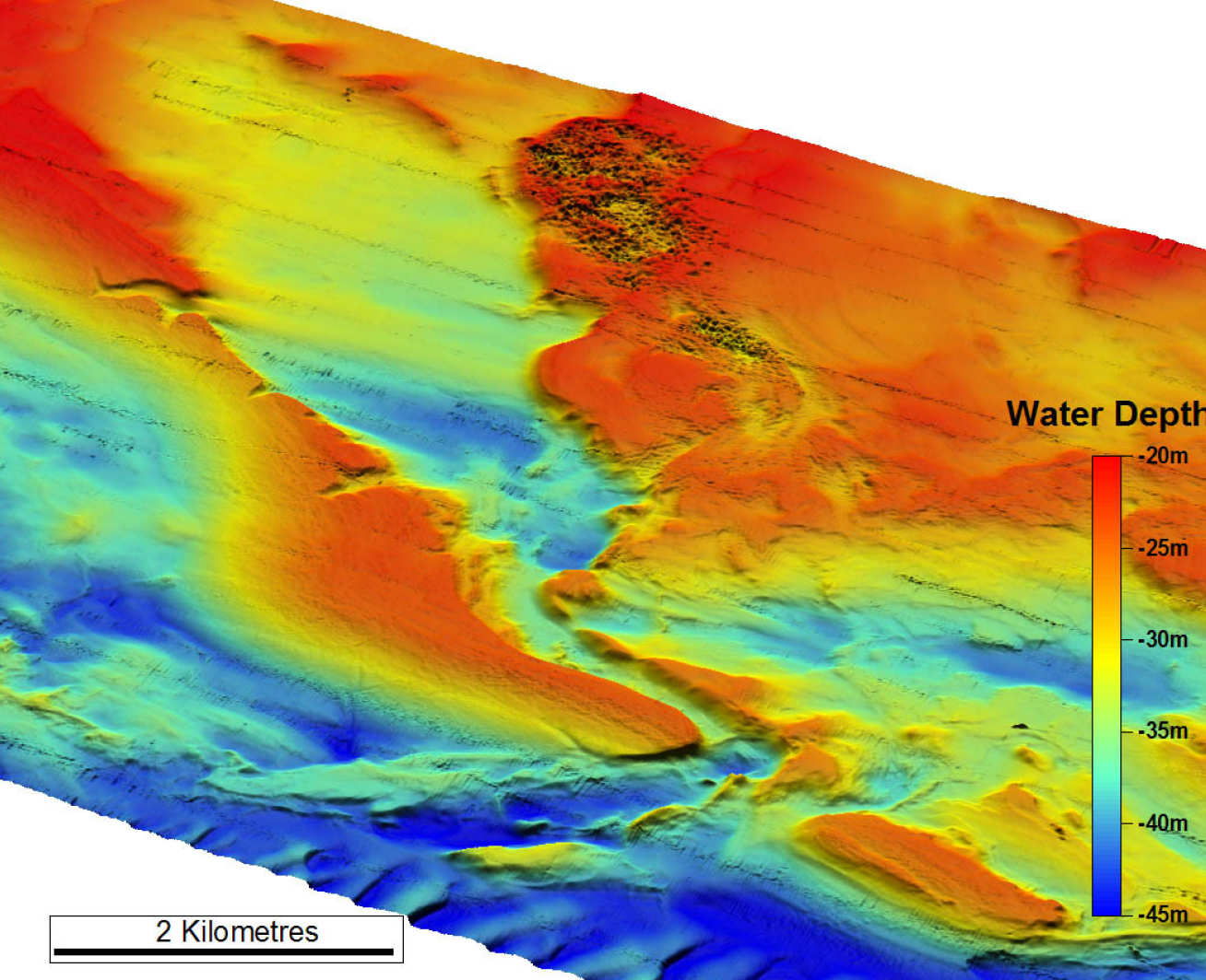
This project used high-resolution geophysical imaging sonars to investigate the geomorphology of submerged and buried landscapes on the northern English Channel shelf. Here submerged fluvial valley systems form important, but poorly understood, palaeo-landscapes on the shelf. Pleistocene sedimentary bodies associated with these valley systems hold considerable potential as aggregate resources, and also contain unique information on the palaeoenvironmental evolution of the region. Moreover, because onshore extensions of these valley systems contain some of the finest records of early human occupation in Britain, palaeo-land surfaces and sedimentary units in their offshore counterparts are likely to contain important archaeological data to help constrain the history of early human migration into Britain. Thus, there is a critical need to assess the archaeological significance of these offshore fluvial systems, prior to extensive aggregate extraction.
During this project we determined the morphology and internal stratigraphy of the relict fluvial valley systems of the offshore extension of the Arun River, off the south coast of Sussex. This was achieved partly by the application of a new suite of high-resolution marine geophysical imaging sonars funded by JREI (Fig.1). We worked closely with Hanson Aggregates Marine Ltd. (principal contact: Dr. Ian Selby) and United Marine Dredging Ltd (principal contact: Dr. Andrew Bellamy), the two main aggregate industry companies operating in the region, who provided extensive seismic and vibracore datasets to the project.
The insights gained from an integrated geophysical/ geomorphological/ sedimentological investigation of these fluvial systems enabled the development of concepts that allowed complex submerged landsurfaces and fluvial facies variations in the subsurface that have extensive potential to contain archaeological resources to be understood and predicted. The new data and technical developments provided by this study contributed to the emerging field of prehistoric marine archaeology, in particular with regard to developing protocols to assess archaeological resource potential in offshore areas, and to the development of conservation strategies.
Return to Jenny Collier's homepage
Collaborators
Hanson Aggregates Marine Ltd. (principal contact: Dr. Ian Selby) and United Marine Dredging Ltd (principal contact: Dr. Andrew Bellamy). Also Tim Henstock (Univ. Southampton).
Links
English Heritage project description
British Marine Aggregate Producers Association website