Vintage film of Antarctic glaciers hints at early ice shelf collapse
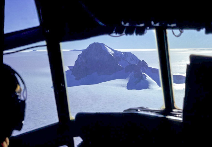
View of Whitmore Mountain in West Antarctica from the research plane
Digitised archival film has revealed part of Thwaites Glacier is melting faster than thought, suggesting the shelf may collapse sooner than expected.
Newly digitised vintage film has doubled how far back scientists can peer into the history of ice in Antarctica, and revealed that an ice shelf on Thwaites Glacier in West Antarctica is being thawed by a warming ocean more quickly than previously thought.
These first measurements of ice thickness have significant value over 40 years later as they allow ice-sheet change observed in the last decade to be placed in multi-decadal context. Professor Martin Siegert
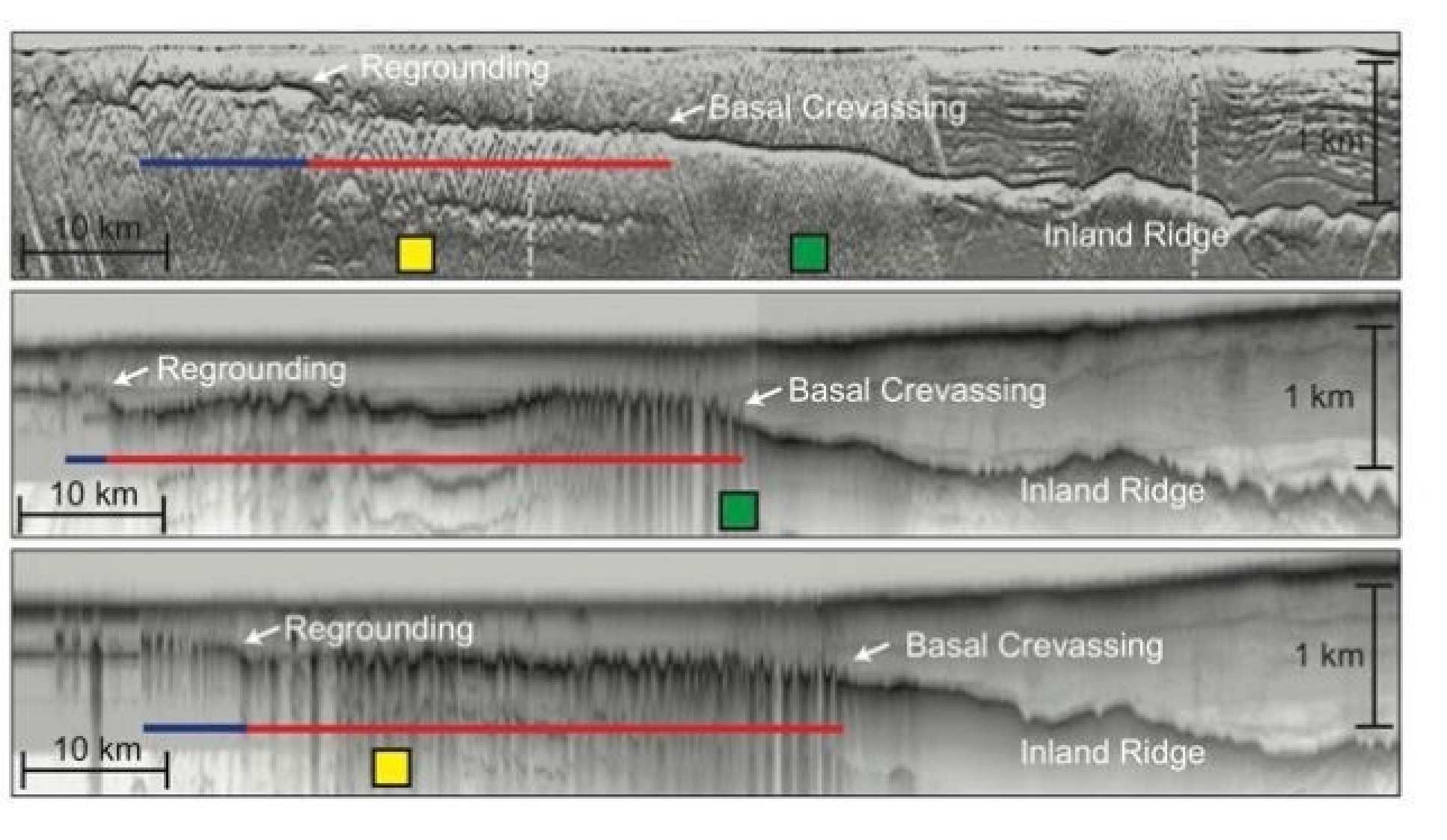
Film from the 1970s has been combined with modern data to estimate that part of Thwaites Glacier thinned between 10 and 33 percent between 1978 and 2009
By extending the record of changes at the base of glaciers and ice shelves in Antarctica, researchers can also better understand the processes that are causing melting, and more accurately predict future sea-level changes.
The team, led by Stanford University and the Scott Polar Research Institute (SPRI) at Cambridge University, and including an Imperial College London researcher, published their findings today in Proceedings of the National Academy of Sciences.
400,000 km of data
Researchers digitised more than 400,000 flight kilometres of Antarctic radar data originally captured on 35mm optical film between 1971 and 1979 by scientists during research flights over the continent.
The film was originally recorded in an exploratory survey using ice-penetrating radar, a technique still used today to capture information from the surface through to the bottom of the ice sheet. The radar shows mountains, volcanoes and lakes beneath the icy surface of Antarctica, as well as layers inside the ice sheet that reveal the history of climate and flow.
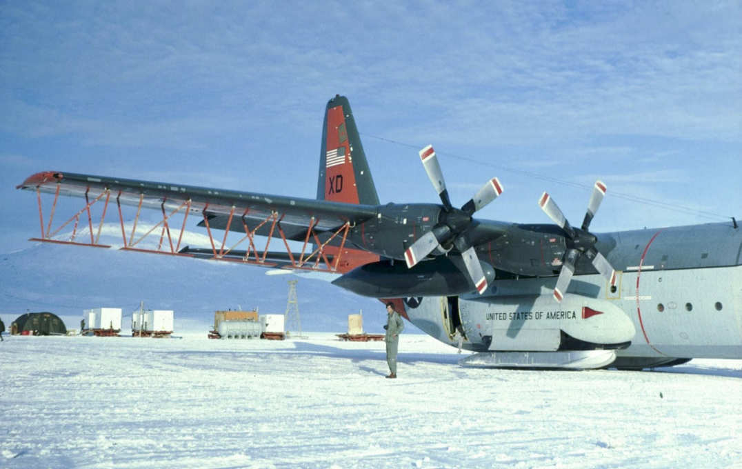
An American military C-130 cargo plane that was converted for Antarctic radar surveys at Williams Field in Antarctica’s McMurdo Sound
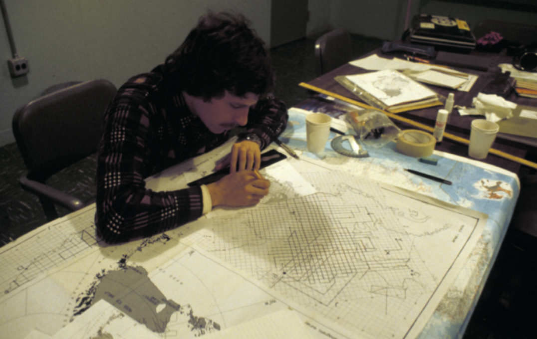
Mapping flight lines
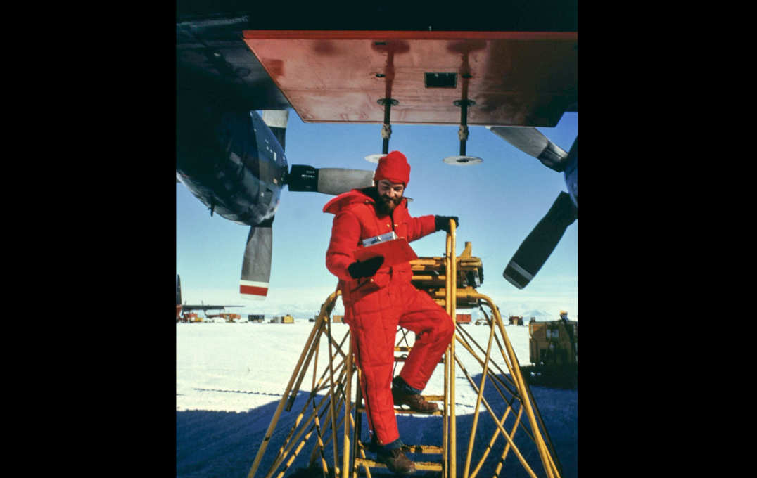
Nils Sko undertaking maintenance on a 300MHz radar antenna on a C-130 plane at McMurdo Sound in Antarctica
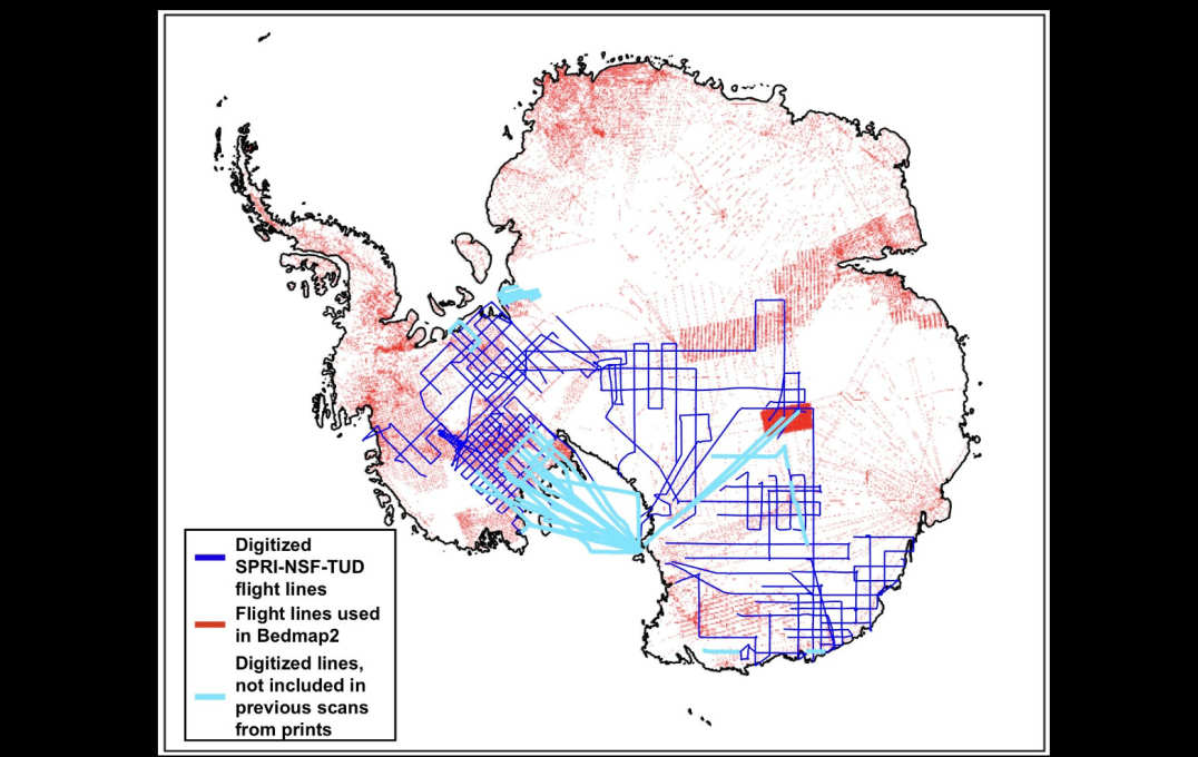
Modern and archival flight lines
Co-author Professor Martin Siegert, from the Grantham Institute at Imperial, has been working with the data for more than 20 years. He said: “In the 1970s around half of the Antarctic ice sheet was explored systematically using airborne surveys. These first measurements of ice thickness have significant value over 40 years later as they allow ice-sheet change observed in the last decade to be placed in multi-decadal context.”
Seeing where the ice could break
Where Thwaites Glacier meets the sea, part of it floats as an ice shelf. Warm ocean water is known to be melting the ice shelf from below, and the new data reveals that it has thinned between 10 and 33 percent between 1978 and 2009.
Lead author Dr Dustin Schroeder, from Stanford University’s School of Earth, Energy & Environmental Sciences, said: “By having this record, we can now see these areas where the ice shelf is getting thinnest and could break through. This is a pretty hard-to-get-to area and we’re really lucky that they happened to fly across this ice shelf.”
He added: “You can really see the geometry over this long period of time, how these ocean currents have melted the ice shelf – not just in general, but exactly where and how. When we model ice sheet behavior and sea-level projections into the future, we need to understand the processes at the base of the ice sheet that made the changes we’re seeing.”
The data has been released to an online public archive through Stanford Libraries, enabling other scientists to compare it with modern radar data in order to understand long-term changes in ice thickness, features within glaciers and baseline conditions over 40 years.
In addition to the radar data, the archive includes photographs of the notebooks from the flight operators – an international consortium of American, British and Danish geoscientists.
-
‘Multidecadal observations of the Antarctic ice sheet from restored analog radar records’ by Dustin M. Schroeder, Julian A. Dowdeswell, Martin J. Siegert, Robert G. Bingham, Winnie Chua, Emma J. MacKie, Matthew R. Siegfried, Katherine I. Vega, John R. Emmons, and Keith Winstein is published in Proceeding of the National Academy of Sciences.
Archive images credit: Scott Polar Research Institute
Based on a press release by Stanford University.
Article text (excluding photos or graphics) © Imperial College London.
Photos and graphics subject to third party copyright used with permission or © Imperial College London.
Reporter
Hayley Dunning
Communications Division