Increasing frequency and magnitude of flooding is perceived to be partly caused by changes in rural land use management, for example deforestation, land drainage and intensification of crop cycles and animal stocking. The effects on flood flows are usually subtle and difficult to predict especially at larger scales. Hence, managing the landscape to control flooding and sediments, at the same time maximising ecological and economic potential, is one of the major challenges facing land managers and environmental agencies. The Flood Risk Management Research Consortium (FRMRC) has been funded for the last 7 years (two phases) to produce the science, databases, models and tools to address this (amongst other) challenges.
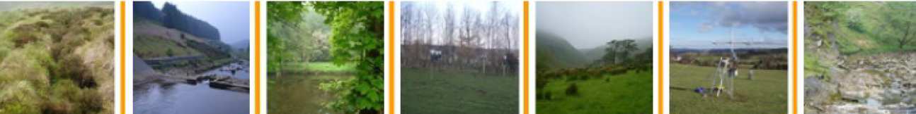
FRMRC Super Work Package 5 (SWP5) is a collaboration of scientists working specifically at addressing issues related to land management and flooding. SWP5 comprises four inter-related work packages. WP1 (flow) and WP2 (sediments) address issues of upland land management. This work has a common focus on the Pontbren experimental catchments in mid-Wales, but also includes extension to other catchments (the Hodder and Eden) and larger scales. WP3 (flow) and WP4 (sediments and ecosystem services) consider the management of lowland wetland catchments, with a common focus on the Parrett catchment in SW England.
Imperial college leads WP1, working in collaboration with Newcastle University. The WP is concerned with the effects of upland land management on flood hydrology. Under FRMRC1, a detailed multi-scale experimental data-base was developed for the Pontbren catchment, a tributary of the Severn, in mid-Wales. The data have been used to provide new evidence of land management effects on flows and have supported development of new modelling approaches and method inter-comparisons. FRMRC1 modelling research addressed impacts of land management at Pontbren. Under FRMRC2 locations of interest have been extended to include the Hodder catchment (and in particular the SCAMP project area in the Hodder catchment) and the Upper Severn. A new multi-scale modelling methodology was developed for Pontbren under FRMRC1. Under FRMRC2 several modelling developments have been pursued.
- New physics-based models have been developed to represent upland peat management associated with grips and grip-blocking and models of afforestation processes. These have been used to develop metamodels for application to the Hodder.
- New Bayesian methods of regionalisation have been developed for prediction of land management impacts for ungauged catchments and tested on Pontbren, the Plynlimon paired catchments in Wales and the Hodder.
- A Source-Pathway-Receptor Modelling Framework has been developed that identifies, using information tracking, those areas in a catchment that make a major contribution to the downstream flood hydrograph, and hence for which land management interventions would be most effective (Newcastle).
The modelling studies have provided additional evidence of land management effects from local to meso-catchment scales and the key uncertainties; and form the basis for a new set of guidelines for good practice in modelling land management effects.
Full details of the scientific advances made during this research programme can be found in the journal publications listed below, and a summary of the new evidence delivered is published as a BHS Symposium proceedings paper.
International workshop and review paper
An international workshop on "Modelling land use change impacts on flood responses" was held at Imperial College on 13-14 June 2011. The proceedings of the workshop were presented at the BHS Symposium in July 2012 and can be read here . The workshop brought together scientific experts from around the world to exchange results and ideas and to identify research needs and priorities and ways forward in the context of predicting land use and management impacts on flooding. The meeting was attended by researchers (including five researchers from the EWRE group of the department of Civil and Environmental engineering) funded through FRMRC2 , in addition to ten national and international researchers who specialise in aspects of modelling land use impacts on flooding. In total there were sixteen presentations, along with structured discussion sessions. The workshop covered themes relevant to prediction of land use impacts, such as novel numerical modelling techniques, uncertainty quantification and propagation, prediction in ungauged basins and case study applications. The presentations from the event can be accessed here and further details.
Dissemination event
On the 4th of July 2011, a one-day event was held at Imperial College, aimed at the environmental agencies, land custodians, consultants and all other parties with a stake in how the rural landscape is managed to control floods and sediments. The key outputs from the FRMRC2 research, and other contributing research, were presented, with the aim of bringing our new science and tools to the user community. The event was attended by over 30 participants from government, NGOs, research institutes, universities and private consultancies. The event, which was structured to include technical presentations and focused discussion sessions, provided an invaluable opportunity to share the outputs from the research programme, receive feedback from a wide range of stakeholders and to discuss future research needs. Further details can be found here. A summary of the work was also presented at the Royal Society at the FRMRC2 event, along with all the other FRMRC2 outputs, which can be watched online http://www.floodrisk.org.uk/.
Pontbren experimental database
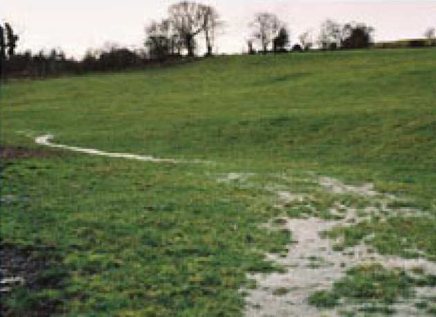
The Pontbren experimental programme has made a significant contribution to the understanding of the impacts associated with land use change on hydrological processes, soil physical properties and hydrological response across a range of scales. A database of all of the measurements made within the catchment over both phases of FRMRC has been compiled and is available via the CEH information gateway https://gateway.ceh.ac.uk/home.
Land-use mangement
Peer Reviewed publications
Ballard, C, E. McIntyre, N., Wheater, H.S., (2012) “Effects of peatland drainage management on peak flows”. Hydrol. Earth Syst. Sci., 16, 2299–2310, 2012
Ballard, C.E., McIntyre, N., Wheater, H.S., Holden, J., Wallage, Z.E. (2011) Hydrological modelling of drained blanket peatland, Journal of Hydrology, 407:81-93, doi:10.1016/j.jhydrol.2011.07.005.
Bulygina, N., C. Ballard, N. McIntyre, G. O’Donnell, and H. Wheater (2012), Integrating different types of information into hydrological model parameter estimation: Application to ungauged catchments and land use scenario analysis, Water Resour. Res., 48,W06519, doi:10.1029/2011WR011207.
Bulygina, N., McIntyre, N., Wheater, H., (2012). “A comparison of rainfall‐runoff modelling approaches for estimating impacts of rural land management on flood flows”, Hydrology Research, In press.
Bulygina, N., McIntyre, N., Wheater, H., (2011). “Bayesian conditioning of a rainfall‐runoff model for predicting flows in ungauged catchments and under land use changes”, Water Resources Research, VOL. 47, W02503, 13 PP., 2011 doi:10.1029/2010WR009240.
Bulygina, N., McIntyre, N., Wheater, H. (2009) “Conditioning rainfall-runoff model parameters for ungauged catchments and land management impacts analysis”. Hydrology and Earth System Sciences 13, 6, 893-904.
Ewen, J., O’Donnell, G., Bulygina, N., Ballard, C., and O’Connell, E. (2012) “Towards understanding links between rural land management and flooding downstream” Quarterly Journal of the Royal Meteorological Society. In press.
Jackson, B. M., Wheater, H. S., Mcintyre, N. R., Chell, J., Francis, O. J., Frogbrook, Z., Marshall, M., Reynolds, B., Solloway, I. (2008). "The impact of upland land management on flooding: insights from a multiscale experimental and modelling programme." Journal of Flood Risk Management 1(2): 71-80.
Marshall M.R., Francis, O. J., Frogbrook, Z. L., Jackson, B. M., Mcintyre, N., Reynolds, B., Solloway, I., Wheater, H. S.,Chell, J. (2008). "The impact of upland land management on flooding: results from an improved pasture hillslope." Hydrological processes 23(3): 464-475.
Marshall, M.R., Ballard, C.E., Frogbrook, Z.L., Solloway, I., McIntyre, N., Reynolds, B., Wheater, H.S. (in preparation). “The impact of rural land management changes on runoff processes: results from experimental plots in upland Wales”. Soil use and management.
McIntyre N. (2012) “Apportioning non-linearity in conceptual rainfall-runoff models: examples from upland UK catchments”. Hydrology Research, In review.
McIntyre N, Marshall M. (2010) “Identification of rural land management signals in runoff response”. Hydrological Processes, Volume 24, Issue 24, pages 3521–3534, DOI: 10.1002/hyp.7774
McIntyre, N, Young, PC, Orellana, B, Marshall, M, Reynolds, B, Wheater, HS. (2011). Identification of nonlinearity in rainfall-flow response using data-based mechanistic modelling. Water Resour. Res., doi:10.1029/2010WR009851.
McIntyre, N., Marshall, M. (2008). “Field verification of bed-mounted Acoustic Doppler Velocity meters”. P I CIVIL ENG-WAT M, 161, 4, 199-206.
Wheater, H. S., Mcintyre, N., Jackson, B. M., Marshall, M. R., Ballard, C. E., Bulygina, N. S., Reynolds, B., Frogbrook, Z. (2010). “Multiscale Impacts of Land Management on Flooding”. Flood Risk Science and Management. G. Pender and H. Faulkner. Oxford, UK, Wiley-Blackwell: 39-59.
Wheater, H.S., Ballard, C., Bulygina, N., McIntyre, N. and Jackson, B.M. (2012) “Modelling Environmental Change: Quantification of Impacts of Land Use and Land Management Change on UK Flood Risk” In: System Identification, Environmental Modelling, and Control System Design, Eds. L. Wang and H. Garnier, Springer-Verlag, London, pp.449-481.
Conference Papers
Almeida SL, Bulygina N, McIntyre N, Wagener T, Buytaert W (2012) “Predicting flows in ungauged catchments using correlated information sources” Proc.British Hydrological Society, Symposium, Dundee, 9-11 July 2012.
Ballard, C. E., McIntyre, N,.Wheater, H. S.. (2010). “Peatland drain blocking – Can it reduce flood risk?”. In: BHS 2010: Role of Hydrology in Managing Consequences of a Changing Global Environment, Proc. BHS Third International Symposium, Newcastle, 19th-23rd July 2010.
Ballard, C.E., McIntyre, N. and Wheather, H.S. (2011) "THe role of physics-based models for simulating impacts of rural land management change on peak flow response", New Zealand Hydrological Society, 5-9 December 2011.
Bulygina, N, McIntyre, N., Ballard, C., Wheater, H. S. (2010). “Bayesian conditioning of a rainfall-runoff model for predicting flows in ungauged catchments and under land use changes”. In: BHS 2010: Role of Hydrology in Managing Consequences of a Changing Global Environment, Proc. BHS Third International Symposium, Newcastle, 19th-23rd July 2010.
Jackson, B., McIntyre, N., Wheater, H., Francis, O., Frogbrook, Z., Marshall, M., Reynolds, B., Solloway, I., (2008). “Upscaling flood runoff from hillslope to catchment scale: a case study in an upland Welsh catchment”, BHS Symposium 2008.
Marshall, M., Mcintyre, N., Wheater, H., Reynolds, B., Frogbrook, Z., Solloway, I., Jackson, B. Bulygina, N., (2009). “The Pontbren Catchment Study: Investigating the impact of upland land management on flood generation”. At the Environment Agency Flood and Coastal Defences Conference, Telford.
McIntyre, N & 21 co-authors (2012) “Modelling the hydrological impacts of rural land use management: current state of the science and future challenges” Proc. British Hydrological Society, Symposium, Dundee, 9-11 July 2012.
McIntyre, N & 19 co-authors (2012) “The potential for reducing flood risk through changes to rural land management: outcomes from the Flood Risk Management Research Consortium” Proc. British Hydrological Society, Symposium, Dundee, 9-11 July 2012.
Wheater, H.S., Jackson, B.M., McIntyre, N. (2009). “Modelling effects of rural land management on flood risk” 2009.. Proc. of Water, Environment, Energy and Society (Vol. 1), New Delhi, Jan 2009, p524-529.
FRMRC1 Project Report
Wheater, H.S., Reynolds, B., McIntyre , N ., Marshall, M., Jackson, B., Frogbrook, Z., Solloway, I., Francis, O.J. and Chell, J., 2 008. Impac t s of upland land management on fl ood risk: multi-scale modelling methodology an d resul ts from the Pon t bren experiment , FRMRC Research Report UR 16, Imperial College & CEH Bangor. pp. 163.
Contact us
Ms Judith Barritt
Tel: +44 (0)20 7594 5967
Email: J.barritt@imperial.ac.uk
EWRE General Office (Room 230),
Department of Civil and Environmental Engineering.