Seafloor Imaging and Processes
It is no exaggeration to say that the knowledge of the surface of our own planet lags behind those of our near neighbours. The water layer that blankets 70% of the surface of the Earth shields it from satellite imagery. Whilst much has been learnt by indirect methods in the deep oceans (satellite altimetry – measuring the height of the sea surface or geoid and exploiting the fact that this surface is a gravitational equipotential) the shallow-water continental shelves that surround us cannot be studied with this technique and so remain largely unexplored. Several marine nations have undertaken full mapping programs of their territorial waters, including our neighbours Ireland. Yet in the UK, despite our island status and long-history of marine research we have covered very little. Much of the future work is likely to be driven by the growing need to inform management of our marine resources, but fundamental science also waits to be discovered.
My group uses high-resolution geophysical imaging equipment (MBES, SSS and boomer/sparker seismic) to study a range of environmental and Earth system processes that have left a record on the seabed.
[See here for Jenny Collier's deep-water research]
Please email me if you are interested in joining my group or would like further information.
Return to Jenny Collier's homepage
Research projects
Volcano monitoring
The most famous submarine volcanoes are those that lead to the formation of new islands, such as the eruption of Surtsey in Iceland in the 1960’s. However, many more volcanic cones spend their entire lives below the waves. Unlike their terrestrial counterparts, the activity at these volcanoes cannot be monitored using satellite technologies that today can detect changes in elevation to a cm scale on an almost daily basis. Within the ocean this job is much more difficult and so we know comparatively little about the patern of activity on fully submerged volcanic cones. We have recently completed a study of Kick-em Jenny volcano in the Caribbean and show it to have periods of cone growth and flank collapse. These processes are similar to the much-better studied terrestrial examples nearby such as Soufriere Hills, Montserrat.
Habitat mapping
Seabed habitat quantification is an emerging field which has been stimulated by the potential benefits of the Blue Economy. This is the most applied type of science I conduct, and benefits from the cross-fertilisation of methods and ideas that are more evolved in the purer research areas I am involved in. The work addresses the need to better understand the spatial distribution of biological resources on continental shelves to allow more informed decisions over the potential environmental impact of human activities (such as wind farm installations, aquaculture, communication cable laying etc). The problem to be solved is how to achieve seabed (benthic) habitat mapping with a spatial resolution and accuracy that closely matches that of terrestrial mapping. Currently seabed characterization relies on direct sampling with spot grabs which is both costly and gives an incomplete picture of the environment. We use a acoustic imaging to provide 100% seabed coverage to tackle this issue.
- Detecting environmental change following coral reef bleaching in the Seychelles
- Seabed habitat mapping in Scotland
- Seabed habitat mapping off the UK east coast
Quaternary landscape
Throughout much of the Quaternary period large expanses of the UK continental shelf was exposed as dry land. As the ice sheets advanced, the major rivers of southern England and northern France extended out onto this ever growing land expanse. However, when the ice sheets melted, the areas were drowned, except a chalk ridge stood between southern England and northern France such that the English Channel and North Sea were separate water bodies. We have used a variety of marine geophysical methods to explore these ancient landscapes, many of which are preserved on the floor of the present English Channel.
- Catastrophic flooding of the English Channel
- Reconstruction of Prehistoric landscapes of the palaeo-Arun River
Geological mapping
In this research area we have developed protocols to map seabed bedrock geology from remotely sensed acoustic imagery (MBES and SBES). I have worked with a number of collaborators, most recently with those from the British Geological Survey to extend our knowledge of the UK's geological resources offshore. Some of this work has taken place within the Jurassic Coast World Heritage Site, famed for its diverse geology.
Background
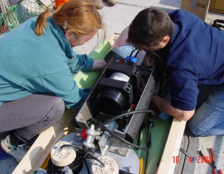
High-resolution sonars for shallow water imaging
People
- Jenny Collier
- Rob Allen (PhD student)
- Cameron Berry (MSci student, Graduated)
- Francesca Oggioni (PhD student, Graduated)
- Kerry Bushe (PhD student, Graduated)
- Stuart Humber (PhD student, Graduated)
- Chris McGonigle (now at University of Ulster)
- Andy Palmer Felgate
- Julie Dickinson
- Ben de Mol
- Jon Pye
External collaborators
- Graeme Potter (UK Hydrographic Office)
- Rob Spillard (Maritime and Coastguard Agency)
- Craig Brown (formerly at University of Ulster)
- Ian Selby (Hanson Aggregates Marine Ltd)
- Andrew Bellamy (United Marine Dredging Ltd)
- Marc de Batist (University of Ghent)
- David Garcia Moreno (Royal Observatory of Belgium)
- Alain Trenteseau (University of Lille)
- Richie Robertson (SRC, University of West Indies)
- Riccardo Arosio (CEFAS)
Funding
I am grateful to the following bodies for funding this work:
Royal Society, Royal Geographical Society, GeoTek, NERC, HEFCE, HEFCW, MALSF