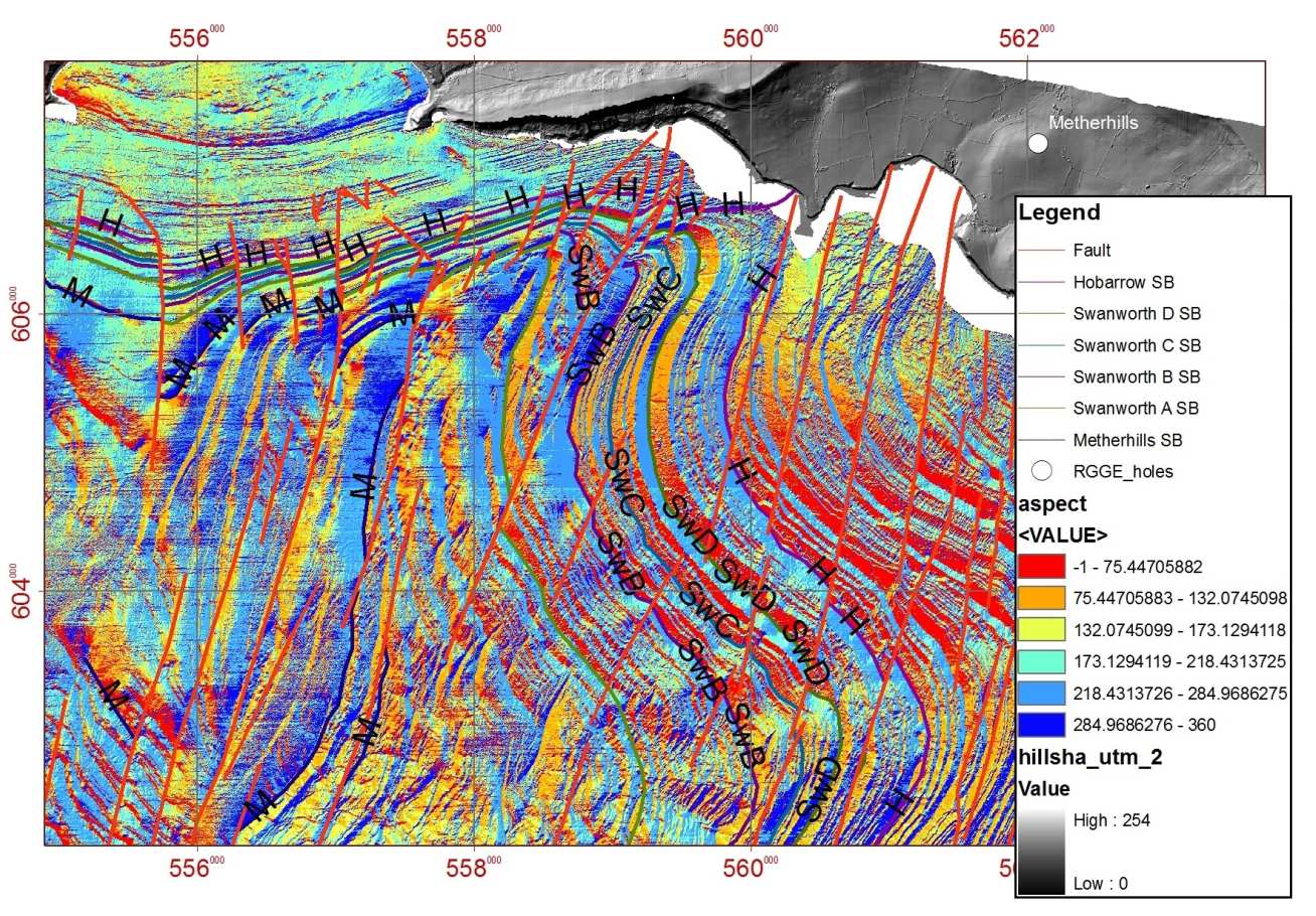
In this research area we have developed protocols to map seabed bedrock geology from remotely sensed acoustic imagery (MBES and SBES). I have worked with a number of collaborators, most recently with those from the British Geological Survey to extend our knowledge of the UK's geological resources offshore. Some of this work has taken place within the Jurassic Coast World Heritage Site, famed for its diverse geology.
Return to Jenny Collier's homepage
Publications
Bosence DWJ, Collier JS, Fleckner S, et al., 2018, Discriminating between the origins of remotely sensed circular structures: carbonate mounds, diapirs or periclinal folds? Purbeck Limestone Group, Weymouth Bay, UK, Journal of the Geological Society, Vol: 175, Pages: 742-756, ISSN: 0016-7649
Westhead RK, McCarthy DJ, Collier JS, et al., 2018, Spatial variability of the Purbeck-Wight Fault Zone-a long-lived tectonic element in the southern UK, Proceedings of the Geologists' Association, Vol: 129, Pages: 436-451, ISSN: 0016-7878
Sanderson DJ, Dix JK, Westhead KR, et al., 2017, Bathymetric mapping of the coastal and offshore geology and structure of the Jurassic Coast, Weymouth Bay, UK, Journal of the Geological Society, Vol: 174, Pages: 498-508, ISSN: 0016-7649
Collier JS, Gupta S, Potter G, et al., 2006, Using bathymetry to identify basin inversion structures on the English Channel shelf, GEOLOGY, Vol: 34, Pages: 1001-1004, ISSN: 0091-7613